VOCABULARY
|
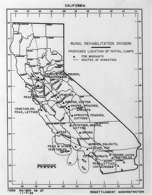
PRIMARY RESOURCE Map of California by the Rural Rehabilitation Division showing areas where different crops are grown, proposed location of initial camps for migrants, and routes of migration. The proposed location of camps to be built by the government are triangles. The arrows show routes the workers would take to go from harvesting one crop to another. The date of the map is estimated to be 1935, a few years after the story in Esperanza. Why do you think the government got involved in building camps for migrant workers? |
http://www.loc.gov/pictures/item/2002723443/
|
